
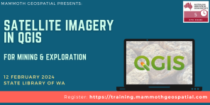
Satellite Imagery in QGIS for Mining & Exploration
Discover the world of free satellite data in QGIS for mineral exploration and earth observation, with our upcoming in-person course led by QGIS experts and certified trainers Grant Boxer and John Bryant.
In this session, we’ll:
? Learn how to find, download, and work with ASTER, Landsat, and Sentinel 2 imagery.
? Understand how to create enhanced images from different spectral bands.
? Dive into practical workflows covering image processing, band ratioing, basic mineral mapping, and PCA analysis to better understand geological and surface features.
Registration
Cost to register is $500. Discounted rate of $425 for AIG members.
Register HERE. |
 -
Date and time
Monday, 12 Feb 2024
9:00 AM – 2:30PM AWST
-
Venue
State Library of WA, Perth Cultural Centre
25 Francis Street, Perth WA
|